Feeds:
Posts
Comments

The M and K Trail

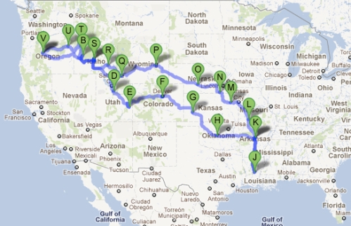
Mike and I logged just under 6,000 miles in the 30 days we were gone, from September 21 to October 22. We stayed at Mike’s folk’s house in Greenbrier for a combined eight days, and for three days with Gary and Tracy Vaughn in Louisiana. We stayed with sister Raine and her husband Chris for two days – one day going and one day on the way home. We lingered two nights each in Moab, Pocatello and Baker City. The other 17 days were all one-night stands: setting up, settling in, and breaking camp the next morning. We found RV parks on our GPS, and made up the rest as we went.

Kyla’s Top Five: Visiting Raine and Chris and the Heart Tree in Hailey, Idaho; ogling the ruby slippers in the Oz Museum in Wamego, Kansas; tagging monarch butterflies in Kansas City, Missouri; rousting through flea markets with Peggy in Greenbrier, Arkansas; and snuggling in the RV with Pip to write blogs.

Mike’s Top Five: Standing in the six-foot Guernsey wagon ruts in Wyoming; visiting his folks in Greenbrier, Arkansas; exploring Fort Laramie in Wyoming; riding into the history of the Pony Express Museum in Marysville, Kansas; and turning a gas shortage into a pleasant experience on South Pass, Wyoming.

We’ve probably forgotten more than we remember, ate more junk food in a month than the entire previous 12 months combined, and learned to work as a team, capitalizing on each other’s strengths and picking up the slack whenever needed. We both experienced highlights that will stay with us forever. For my part, I’ll remember the freedom of being self-contained, figuring out the promises and problems of each day, and letting the wind blow us where it would.

Our Map:

V:             Bend, Oregon

B:             Idaho City, Idaho

S:            Hailey, Idaho

D:            Provo, Utah

E:            Moab, Utah

F:            South Park, Colorado

G:            Garden City, Kansas

H:            Oklahoma City, Oklahoma

I:            Greenbrier, Arkansas

J:            Alexandria, Louisiana

K:            Greenbrier, Arkansas

L:            Springfield, Missouri

M:            Topeka, Kansas

N:            Fairbury, Nebraska

O:            Gothenburg, Nebraska

P:            Glenrock, Wyoming

Q:            Kemmerer, Wyoming

R:            Pocatello, Idaho

S:            Hailey, Idaho

T:            McCall, Idaho

U:            Baker City, Oregon

V:            Bend, Oregon

Scroll around our map, below:
Decision at The Dalles

Decision at The Dalles
God never made a mountain that had no place to go over it or around it. –Samuel K. Barlow, 1845

The Columbia River could swallow them whole, in an instant, never to be seen again. Men, women, and children – alike and without discrimination. When pioneers on the Oregon Trail had traveled over 2,000 miles, through sand and storm, draught and disease, they reached The Dalles, in the promised land of the Oregon Territory. Only 150 miles remained between them and their destination in Oregon City. But first, in The Dalles, a critical decision had to be made: Raft their wagons down the untamed Columbia, or take the cold and rugged Barlow Trail over Mt. Hood? Their lives might very well depend on the route they chose.

The Columbia River – Then and Now
Then:
The frightening spectacle of traveling the Columbia River on the Oregon Trail is best described in an account from Jesse Applegate, whose family crossed the Oregon Trail in 1843, when Jesse was just a boy of seven. “…the current whirled the nearly vertical raft … as if it were caught in a cyclone. With a horrendous roaring noise, the raft was sucked under the water by the powerful whirlpool. The once exciting, now terrifying, river had literally swallowed up the raft that Jesse has just seen moments ago. After hitting the bottom of the riverbed, the raft was catapulted upward… The bodies of [Jesse’s brother,] Warren, 9, Uncle Mac and [cousin] Edward, also 9, never surfaced again.” (Source: It Happened on the Oregon Trail, Tricia Martineau Wagner.)
Now: Autumn is a beautiful time to go driving and hiking on the Columbia River Gorge. There Between 77 and 90 waterfalls plunge down the Oregon side of the river, with hiking and mountain biking trails throughout. The Columbia River also hosts 50 vineyards that nurture 30-some varietals. The Columbia Gorge Interpretive Center, the riverboat Sternwheeler, and Vista House at Crown Point, all give modern day explorers a glimpse into the rich history of the Gorge. Read more about recreation on the Columbia River: Milestones in Time.

The Barlow Trail – Then and Now
Then:
The last overland segment was by far the most harrowing 100 miles of the Oregon Trail. The road was a mere path between trees, going up steep grades, and crossing boulder-strewn ravines. Many emigrants were cold and hungry; some were sick from exposure. Many of the livestock died from eating the poisonous rhododendron leaves. Fog, rain, or sleet slowed their progress and camps were made under any shelter that could be improvised. In his journal, pioneer Joe Palmer (1845) recorded that he “…stood shivering in the rain around the fire, and, when daylight appeared, it gave us an opportunity to look at each other’s lank visages. Our horses were shivering with the cold, the rain had put out the fire, and it seemed as though every thing had combined to render us miserable.” The hardest part of the journey, however, was the descent. In addition to the swampy bogs and dense forests, there was the famous Laurel Hill. The slope was so steep that only a few “laurels” clung to it – since the leaves are similar, the pioneers mistakenly called the rhododendrons laurel. In places the grade on Laurel Hill was 60% – more vertical than horizontal. (Source: Mt. Hood National Forest)
Now: Today’s travelers can still travel the historic Barlow Trail: bike it, hike it or drive it. From Sandy to Oregon City, the trail runs 61 miles round trip. Fall colors on the Barlow Trail are particularly stunning and the crowds, bustle and bugs of summer have happily dispersed. Spend a leisurely three hours in your car or a four-hour one-way bike ride, and find yourself in footsteps of history. More on the Barlow Trail: Following in the Footsteps of History.

The Lone Tree

Baker City, Oregon

October 21, 2011

Day 29

Accumulated Miles: 5,724

Photo by Daniel C. Hyde

When the pioneers rolled into the Baker City area they saw, in the broad valley below, a tall and solitary tree, marking their way forward. The venerable pine, called I’arbre seul (the lone tree) by French-Canadian fur trappers, towered majestically above the broad valley floor for centuries. It served as a landmark for Indians, trappers, missionaries, and Oregon Trail emigrants, until felled in 1843 by what explorer John Fremont called, “some inconsiderate emigrant ax.”

It must have been a sight of inspiration to travelers, who had come some 1,800 grueling miles for a tall and singular purpose: to start a new life in the Willamette Valley.

Today, the Oregon Trail Interpretive Center commemorates that journey with intricate exhibits, living history, multi-media presentations, artifacts, four miles of interpretive trails, and remnants of wagon ruts traveled by the pioneers. The Center itself creates an amazing journey back in time.

Though the ponderosa pine that once stood on the valley floor is long gone, it’s easy to imagine its solitary presence. As a traveler to strange and different lands, one often feels like a lone tree in a broad landscape where nothing else matches. Or even comes close.

Adandoning the Trail

McCall, Idaho

October 19, 2011

Day 27

Accumulated Miles: 5,333

Payette Lake, McCall, Idaho @City of McCall

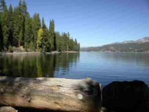
We’ve abandoned the Oregon Trail for the sweet little Idaho town of McCall, where recreation reigns supreme. That would be because of the lake, the ski mountain and the miles and miles of wooded trails surrounding the city. We ate steak, halibut and baked potatoes with all the fixins for dinner. McCall is a place I can almost imagine staying, except they are lacking a dramatic mountain range that I can’t seem to live without, called the Cascades.

Driving north on Highway 55, we saw a sign for a pioneer girl’s grave (at Brownlee Campground). So we took the topsy-turvy 25-foot trailer up a narrow, rocky, rutted dirt road in search of this sad place. We parked the Jeep at the first wide spot we came to and hoofed it up the road, letting Pippin run amuck for a mile or so. We never did find the gravesite, which saddened me, because it seems as though we should have paid our respects.

We have followed this 2,000-mile trail in air-conditioned, Diet Coke comfort, while the pioneers risked their lives, their fortunes and their futures on this same long road. For some, the toll was too high, and they should be remembered and wept over.

October 16, 2011

Pocatello, Idaho

Day 24

Accumulated miles: 5,080

Will it End? @Oregon.gov

Everyday Miracles: We laid over in Pocatello for two nights, and I can fully understand how happy Oregon Trail pioneers would be to not be on the move for a brief and happy time. Every day the same routine: wake up, rouse the kids, eat, pack up, round up the livestock, get one’s bearings and head out. At day’s end: reverse the sequence.

In modern parlance we: wake up, walk the dog, eat, pack up, put gas in the car, get one’s bearings and head out. At day’s end: reverse the sequence.

The days of dirt and chores can get tedious. And then – voila! – out of the blue something unexpected and delightful happens. As many challenges and hardships as the pioneers endured, the earth occasionally gave up gifts to these weary and determined travelers. The first was ice. Then, club soda.

Lemonade on Ice: Somewhere in the middle of Wyoming, roughly 60 miles past Independence Rock, in the dry dusty heat of a 110-degree sun, with no reprieve in sight, came a parched and weary caravan of travelers. Alonzo Delano (1849) had been scouting the area all day by horseback looking for water, and eventually found a running brook that mysteriously disappeared underground. Catching up to his wagon train, he pointed out a boggy, spongy area in the near distance covered with peat moss. He urged his beleaguered colleagues to dig for water and – lo and behold! – they came upon a thick layer of ice a mile wide, with clean cold water running beneath. The dust-caked pioneers drank and splashed and danced for joy. That evening they reportedly enjoyed lemonade over ice with their evening meal. Word spread and the area became known as Ice Spring Slough, a much-coveted stop for Oregon Trail travelers.

A Fizzy Elixir: There is a place in eastern Idaho where club soda bubbles up from the ground into clear pools, streams and shooting geysers. No kidding. Said one pioneer, “The draught will prove delicious and somewhat stimulating, but, if repeated too frequently, it is said to produce a kind of giddiness like intoxication.” Naturally, Soda Springs became a popular stopover for travelers on the Oregon Trail. More than 100 springs once sprang up in the area, though most have disappeared over time. One still percolates under a reservoir and can be seen from a golf course. Another has been turned into a town attraction, where you can still drink the bubbly water in a little park setting.

My Own Oregon Trail

Driving almost 6,000 miles over the past four weeks, being gainfully self-unemployed, and feeling adrift in many ways, I harbored this notion that we would stumble into some outrageously charming little city with a “Kyla Wanted” sign in the center of town. Moab? Laramie? Pocatello? McCall? Baker City?

My town would say, “Here Kyla. Be here, stay here, love and be loved. There are unexpected gifts for you here.” I was listening. I was searching. But I didn’t find any such place.

Did I had to drive 6,000 miles to discover that home was right where I left it, and right where I belonged the whole time? I don’t think that I’m like Dorothy Gale. I belong over the rainbow. My home goes with me, wherever my own yellow brick road takes me.

I’m reminded that some pioneers never found the coveted Ice Slough on the Oregon Trail. They thought, with some bitterness, that they’d been sold a bill of goods.

Has this same Oregon Trail left me wandering through a hot and desolate prairie looking for an elusive source of cool water? Or – voila! – is something unexpected and delightful about to happen, out of the blue? I don’t know. I’ll probably figure it out, clear as a stream of fresh water, when I get home.

Mine, Mine, Mine

Of Towels, Toothbrushes and the Dog

Photo by Valorie Webster

Mi casa su casa. That’s the rule I live by. If it’s mine, it’s yours. My home, my car, my bike, my love, a cup of sugar, a nice cup of tea, a shoulder to cry on. Whatever I’ve got, it’s yours. This attitude comes in particularly handy when RVing, because when two people and a dog share a teeny tiny little bitty space for 30 days, quarters can get very, very close. So, like I said, what’s mine is yours. Except for three things:

1. My Towel. I know a certain husband who was shown a certain towel, in a particular shade of brown. It was known very clearly as MY TOWEL. Do not use it, do not touch it, do not even look at it. Pretend it’s not there. And to be sure you’ve got this clear in your head, here’s a quiz: What do you do with this brown towel? Answer: What brown towel?

This fine and reasonable agreement lasted about 24 hours, until a certain husband used, yes used, the brown towel. As in USED IT. On his wet person. Very, very bad husband.

2. My Toothbrush. It’s like this: you toucha my toothbrush, I breaka you fingers. ‘Nuff said on that.

3. My Dog. You’d be surprised by how many people have suggested that they pack Pippin up and take him with them. Believe me, I’ve eyeballed plenty of back seats in the past as guests rolled out of our driveway. I know they don’t really mean it, but I also know that somewhere, deep down inside, they want my dog.

Note to such visitors: I own Pippin. He is mine. He is my chattel, my possession, my own personal private property. And I can prove it. Every time he calls, I come, immediately. Every time he wants his belly rubbed, I rub. I feed him, bathe him, dry him up all fluffy with a towel, and take him on long, off-leash romps. In short, I am his bitch. And don’t you forget it.

As our 30 days in a 25-foot trailer wind down, I can tell you one thing for sure: Take this RV. It’s yours.

I Heart Hailey, Idaho

October 19, 2011

Day 27

Accumulated Miles: 5,215

Heart Tree @CatChanel's Flicker Photostream

My sister, Raine, and her husband, Chris, live in Hailey, Idaho, a location so idyllic some people refer to it as “living in a Ralph Lauren ad.” Set a few miles south of Sun Valley and a few more miles south of Ketchum, Hailey is a bedroom community for the common folk who serve the glamorous and fabulously wealthy jet setters who drop into Sun Valley to ski every winter and otherwise recreate and hobnob in the summer months. Raine and Chris are wonderful, loving, fun people who always open the door to their home and their spare bedroom to us whenever we drop by (450 miles from home).

I like Hailey and so does my dog. Here are two good reasons:

1. Heart Tree: One block from Raine’s/Chris’ house is a trail that follows the Wood River, laced this time of year with yellow leaves and the smell of seasons changing. The trail gives good access to fetch-and-splash spots for Pippin, Joe and Gravy (three of the sweetest, bestest dogs ever) as it winds through the alder and aspen trees.

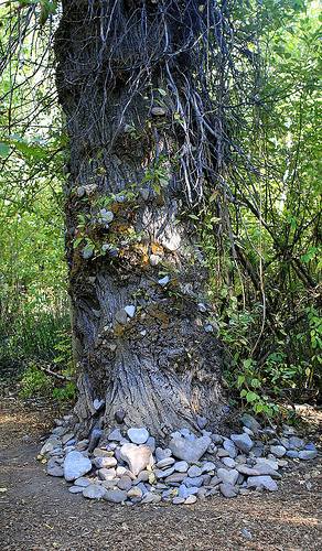
Rounding a corner is an unexpected sight – part nature, part nurture – that will take your breath away. Heart Tree has grown up from the land and embellished by the people who love it, and each other. There, you’ll find hundreds of heart-shaped stones wedged in the tree’s bark and branches, and scattered at the base. Take a stone, leave a stone, but I defy your happy or hardened heart to leave this little spot of terra firma untouched.

Note: I poached this image from CatChanel’s photostream on Flicker because I didn’t have my trusty camera with me. Thank you CatChanel.

Greenhorn Gulch @Trails.com

2. Greenhorn Gulch: Miles and miles of single track: up up up, down, around and across. That is the best way to describe this sweet little trail, used by hikers, bikers, and horseback riders. Raine, Pip, Joe and I had the whole Greenhorn-Mahoney Loop (45 minutes of it) to ourselves this particular day, surrounded by varying shades of autumn yellow and the sounds of Greenhorn Creek. The creek – on the “down and across” portion of the trail – has spectacular spots for dogs who relish every opportunity to stick their feet and faces in the cool clear mountain water.

Note: Some say this loop is five miles, others say it’s 12.5 and yet another website says hundreds. We took a lovely 45 minute bite out of this wonderful spot. More info and map from Trails.com.

The Oregon Trail of Graves

Ash Hollow, Nebraska

October 14, 2011

Day 22

Accumulated Miles: 4,136

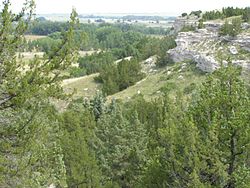
Ash Hollow, Nebraska @ Wikipedia

Plodding along the Oregon Trail must have been an exhausting affair: monotonous hours, weeks, and months of tedious progress punctuated with short episodes of abject terror.

Word was sent back east of treacherous river crossings, terrifying Indian encounters, wild stampedes, hunger, heat and thirst.

Dreadful stories were written, told, and retold to aspiring pioneers. But some dreams just cannot be beaten down. As vividly forewarned as would-be pioneers were of the many dangers and hardships on the Oregon Trail, nothing seemed to dampen their excitement and optimism as they planned for the long journey, and dreamed of their new, abundant life in Oregon Territory.

But then came the “unseen destroyer,” cholera, which caused wide-spread and devastating sickness on the Oregon Trail.  One bride of note, Rachel E. Pattison, 18, was married two months and “honeymooning” on the Oregon Trail in 1849. She was said to have felt fine in the morning, fell ill by noon, was in agony soon after, and  dead by dinnertime.

An average of fifteen people died on every mile of the Oregon Trail, mostly from cholera, which was caused by bacteria in unsanitary conditions. Drowning during river crossings, wagon accidents, rattlesnake bites, conflicts with Indians, and exposure to the elements took many more lives on the Oregon Trail.

Loren Hastings (1847) said, “I look back upon the long, dangerous and precarious emigrant road with a degree of romance and pleasure; but to others it is the graveyard of their friends.”

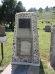
Rachel E. Pattison (1831-1849)

The majority of graves on the Oregon Trail remain unmarked. Many bodies were buried directly under the trail, so that the remains would be hidden, trodden upon, and lost, and therefore safe from desecration by Indians and wild animals.

Some pioneers paid a terrible price for their dreams. Others struck it rich. Most carved out simple lives of satisfaction mixed with hard work.

You can see Rachel Pattison’s grave just outside of Ash hollow, Nebraska  – a marker of dreams, hope, faith and the cruel strokes of fate and misfortune. You can also still drink from the pool of clear water that bubbles to the surface in Soda Springs, Idaho – a reminder of naturally occurring, everyday miracles.

A Mythical Ass-Kicking

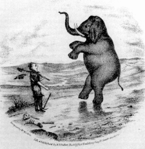
A popular and uniquely American phrase became popular during the mid-1800s with respect to the great migration west. “Seeing the Elephant” implied overwhelming emotions, and could in turn symbolize excitement, disenchantment, success or defeat. Some examples:

“Oh the pleasures of going to see the Elephant!!” – Lucy Rutledge Cooke, 1852

“We are now advanced on our trip about 200 miles and in all this trip I have not seen the ‘Elephant.’ I am told, however, that he is ahead, and if I live, I am determined to see him.” – A doctor in a letter to his wife

“Now methinks I see the elephant with unclouded eyes.” –Joseph Wood

“That desert is truly the great Elephant of the route and God knows I never want to see it again.” –Lucius Fairchild, 1949

Pioneers of the Oregon Trail would talk with great excitement and anticipation about heading west to “see the elephant” of new and exotic places. (I am reminded of a certain middle-aged woman with a desk job who posted, “Okay 2011, bring it” on her Facebook page last January.)

Such anticipation often met with great disappointment or tragedy. While one person might say they are anxious to “see the elephant” of the exciting new world, others saw the elephant of tribulations and never wanted to see the beast again. In the most extreme cases, seeing the elephant would mean the final straw of failure and a return trip home. Extreme excitement followed by tremendous frustrations epitomized the mythology of the elephant on the Oregon Trail.

Perhaps pioneers had fixed their eyes on the rich and fertile Oregon Territory and overlooked the 2,000 miles that lay between their homes in the east and their dreamland in the west. Ultimately, the elephant became a mirror, reflecting back to the pioneers their own emotions.

With regard to my Facebook post: 2011 gave me a one-two punch. I have seen the elephant. And the elephant has kicked my ass. But there is no going back. I am reminded that many brave and persevering pioneers finally found their land of milk and honey, and plowed their dreams into reality. They met the elephant – stared it straight in the face – and moved forward. I might add that, contrary to the popular idiom, they found their happiness in the arrival, not so much the journey.

Markers in Time

Monoliths on the Nabraska Prairie

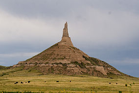
Chimney Rock @Wikipedia

Flat, dry plains stretch across the Oregon Trail in an endless, mind-numbing carpet of dirt scrub and sky. Rivers, streaking through in all directions, counter the monotony with episodes of drama and terror. Rattlesnakes hide in the bushes, or sunbathe on the rocks, storing up venom and dread.

From the air-conditioned comfort of the Jeep, with a cooler full of Diet Coke, and a trailer that will give us shelter, ice cream and hot running water, it’s hard to imagine the hardships of traveling this land in a covered wagon.

Out of this desperate land, however, strange and wonderful rock formations rise up on the landscape, markers in time and clear measures of progress on the long Oregon Trail.

Not only were these geographical monoliths fascinating to eastern flatlanders, they provided recreation, diversion, opportunities for exploration, and places to camp and layover a few days.

Register Cliff @ Wikipedia

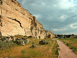
Register Cliff rises one hundred feet above the North Platte River valley. Following a day’s journey from Fort Laramie, emigrants spent the night at Register Cliff and inscribed their names into the rock face. Source: Wyoming Heritage.

Chimney Rock was one of the most picturesque landmarks along the Oregon Trail. It signaled the end of the prairies as the trail became more steep and rugged heading west towards the Rocky Mountains. Many drawings of it were made by surveyors and artists, and most pioneers mentioned it in their diaries. Travelers reported that it was visible forty miles away. Source: History Globe.

Ayers Bridge @ Wikipedia

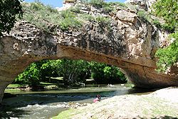
Ayers Bridge: Crafted by the hands of Mother Nature, Ayres Natural Bridge, located just south of the Oregon Trail, is one of only three natural bridges in the United States with water beneath. For the Indians who first lived in this country, the natural bridge was a deadly place. A young brave had been struck by lightning and killed while hunting the canyon. Legend of an evil spirit who lived below the bridge resulted. When white settlers realized the Indians’ beliefs they used the bridge as an escape from Indian attacks. Source: Converse County Tourism.

Independence Rock 1870 @ Wikipedia

Independence Rock: Named for a fur trader’s Fourth of July celebration in 1830, this huge rock became one of the most famous of all Oregon Trail landmarks. The giant piece of granite is 1,900 feet long, 700 feet wide, and 128 feet high. Starting the trail in the early spring, emigrants along the Oregon Trail hoped to reach Independence Rock by July 4, Independence Day. If they had not arrived by then, they knew they were behind schedule. Source: History Globe.

Devil's Gate @Wikipeida

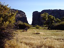
Devil’s Gate: A few miles west of Independence Rock, the Sweetwater threads it way through a narrow canyon called Devils Gate. But the wagons never passed through the chasm; they wisely detoured around. In the early 1860s, four women, members of a wagon train, camped at this point, and climbed to the top of the ridge above the gorge. One of them, 18-years-old, ventured too close to the edge, fell and was killed. She was buried in the gorge and her grave board was inscribed with this epitaph (Source: Oregon Trail 101):

Scott's Bluff @ Wikipedia

“Here lies the body of Caroline Todd
Whose soul has lately gone to God;
Ere redemption was too late,
She was redeemed at Devil”s Gate.

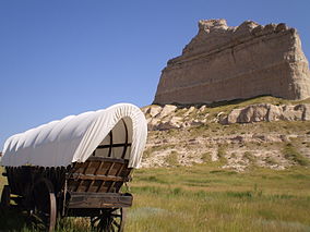
Scott’s Bluff: Towering eight hundred feet above the North Platte River, Scotts Bluff has been a natural landmark for many peoples, and it served as the path marker for those on the Oregon, California, Mormon, and Pony Express Trails. Wagon trains used the bluff as a major landmark for navigation. Source: National Park Service.